The Grand Canyon is not a single overlook or one continuous visitor area. It is an immense landscape shaped by the Colorado River and divided among high rims, deep side canyons, river corridors, historic settlements, Tribal lands, and protected public landscapes.
Exploring the Grand Canyon begins with understanding how these places relate to one another. The South Rim and North Rim face each other across the canyon but are separated by a long drive. Grand Canyon West is located on the Hualapai Reservation rather than inside Grand Canyon National Park. Havasu Canyon is administered by the Havasupai Tribe, while Lees Ferry lies upriver within Glen Canyon National Recreation Area.
This guide introduces the major places that define the Grand Canyon region and helps you choose where to explore next.
A Canyon of Many Places
Grand Canyon National Park protects a large portion of the canyon, including the South Rim, North Rim, inner canyon, and hundreds of miles of the Colorado River corridor. The wider Grand Canyon region also includes lands cared for by Tribal nations, neighboring federal recreation areas, and communities that have long served as points of access to the canyon.
These places are geographically connected, but they are not interchangeable. Each has its own access routes, landscape, history, visitor experience, and land-management authority.
Understanding the Main Areas
The Grand Canyon is commonly approached through four broad geographic areas:
- South Rim: The most developed and widely visited section of Grand Canyon National Park.
- North Rim: A higher, more remote section of the national park with a shorter visitor season.
- Western Grand Canyon: Canyon landscapes west of the national park, including Grand Canyon West on the Hualapai Reservation.
- Eastern Grand Canyon and River Corridor: Desert View, the Little Colorado River, Marble Canyon, Lees Ferry, and the upper Colorado River corridor.
Explore the Major Grand Canyon Regions
South Rim
The South Rim is the best-known section of Grand Canyon National Park. It includes extensive viewpoints, historic buildings, museums, hiking trails, shuttle routes, and some of the park's most accessible educational experiences.
This is where many visitors first encounter the scale of the canyon, but the South Rim itself contains several distinct places worth understanding separately.
Related guides: Grand Canyon Village » | Desert View »
North Rim
The North Rim rises higher than the South Rim and offers a cooler, more forested, and more remote experience. Although the two rims appear close across the canyon, traveling between them by road requires a lengthy trip around the canyon.
The North Rim includes broad viewpoints, forested trails, scenic roads, and access to the North Kaibab Trail.
Grand Canyon Village
Grand Canyon Village is the historic and administrative center of the South Rim. It contains landmark buildings, trailheads, museums, lodging, transportation connections, and some of the park's best-known rim views.
The village is not simply a gateway to the canyon. It is an important historic landscape shaped by Indigenous history, railroad development, early tourism, architecture, conservation, and the creation of the national park.
Desert View
Desert View lies near the eastern edge of the South Rim. The area offers expansive views into the eastern canyon and across the Colorado Plateau, along with the historic Desert View Watchtower and opportunities to learn about the region's associated Tribal communities.
Desert View is connected to Grand Canyon Village by Desert View Drive, a scenic road lined with overlooks and changing views of the canyon and Colorado River.
Colorado River and the Inner Canyon
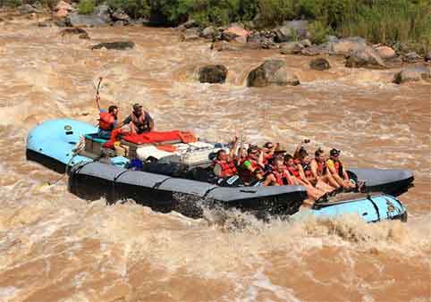
The Colorado River is the central geographic thread of the Grand Canyon. It flows far below the rims through a complex landscape of rapids, beaches, side canyons, archaeological sites, springs, and desert ecosystems.
The inner canyon differs dramatically from the rim. Elevation, temperature, vegetation, water availability, and travel conditions can change substantially during the descent from rim to river.
Grand Canyon West
Grand Canyon West is located on the Hualapai Reservation west of Grand Canyon National Park. It is owned and operated by the Hualapai Tribe and includes Eagle Point, Guano Point, Hualapai Point, and the Grand Canyon Skywalk.
Because Grand Canyon West is not part of the national park, its admission system, transportation, visitor services, and rules are managed separately.
Havasupai and Havasu Canyon
Havasu Canyon lies within the Havasupai Reservation and is administered by the Havasupai Tribe. It is known for waterfalls, travertine pools, red canyon walls, and the village of Supai.
Access is controlled by the Tribe and requires advance reservations. Havasupai is not a casual day-hiking destination and is not administered by Grand Canyon National Park.
Marble Canyon
Marble Canyon forms the northeastern beginning of the greater Grand Canyon river corridor. Here, the Colorado River flows between steep walls before continuing toward the deeper central canyon.
The area is associated with Navajo Bridge, Lees Ferry, river-trip departures, desert landscapes, and important habitat along the Colorado River.
Lees Ferry
Lees Ferry provides rare vehicle access to the Colorado River and serves as the starting point for many river journeys through the Grand Canyon. The area also preserves an important transportation, settlement, and river-crossing history.
Lees Ferry is administered as part of Glen Canyon National Recreation Area rather than Grand Canyon National Park.
Little Colorado River Gorge
The Little Colorado River approaches the Grand Canyon from the southeast and joins the Colorado River deep within the canyon. Its lower gorge is known for steep walls, striking geology, and distinctive blue water under certain natural conditions.
Much of the surrounding landscape is connected to the Navajo Nation and carries profound cultural significance. Visitors should understand land ownership, access requirements, and cultural responsibilities before entering unfamiliar areas.
How the Grand Canyon's Places Connect
The canyon's major regions are connected geologically by the Colorado River, but reaching them by road can require substantial travel around the canyon. A location that appears nearby on a map may be many hours away by vehicle.
Jurisdiction also changes across the region. Grand Canyon National Park, Glen Canyon National Recreation Area, the Hualapai Reservation, the Havasupai Reservation, the Navajo Nation, national forests, and other public lands each have their own responsibilities, access rules, and visitor guidance.
Respect the Landscape and Its Communities
The Grand Canyon is both a protected natural landscape and the ancestral homeland of Indigenous peoples. Before visiting Tribal lands or remote canyon areas, verify current access requirements with the appropriate Tribal government or land-management agency.
Never assume that a viewpoint, road, trail, or river access point is public simply because it appears on an online map.
Continue Exploring GrandCanyon.net
Now that you understand the major places of the Grand Canyon, continue by exploring what people do here, how the landscape formed, and the remarkable destinations surrounding the canyon.
Things to Do at the Grand Canyon »