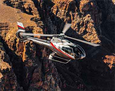
The Grand Canyon belongs to a much larger landscape. Across the Colorado Plateau, rivers, uplift, erosion, wind, water, volcanism, and human history have shaped an extraordinary concentration of canyons, cliffs, mesas, arches, plateaus, volcanic fields, cultural landscapes, and ancient communities.
The name Grand Circle is commonly used for the broad region connecting the Grand Canyon with national parks, monuments, recreation areas, Tribal lands, historic places, and gateway communities throughout northern Arizona, southern Utah, southwestern Colorado, and northwestern New Mexico.
It is not a single official route. There is no required starting point, fixed list of destinations, or standard number of days. Instead, the Grand Circle provides a useful way to understand how the Grand Canyon relates to the surrounding Colorado Plateau.
Understanding the Grand Circle
The Colorado Plateau is centered on the Four Corners region, where Arizona, Utah, Colorado, and New Mexico meet. Much of the plateau is characterized by elevated, comparatively undeformed rock layers that have been cut, exposed, and reshaped into cliffs, stair-stepped plateaus, deep canyons, mesas, buttes, arches, and badlands.
Many Grand Circle destinations reveal different chapters of the same regional story. Rock layers exposed near the top of the Grand Canyon continue northward into the cliffs and plateaus of southern Utah. The Colorado River links the Grand Canyon to Glen Canyon, Canyonlands, and distant mountain watersheds. Cultural connections cross modern park, state, and reservation boundaries.
The Grand Circle Is a Region, Not a Checklist
The Grand Circle contains far more places than anyone can understand during one hurried trip. A meaningful visit may focus on a single landscape, a connected group of parks, one river corridor, or a particular cultural or geological theme.
GrandCanyon.net uses the Grand Circle as an educational framework, not as a race to collect destinations.
Major Grand Circle Destinations
Grand Canyon National Park
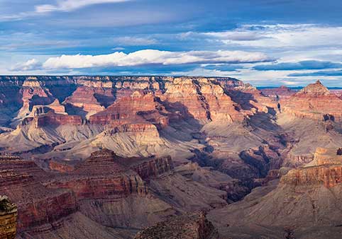
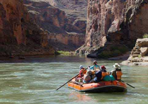
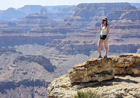
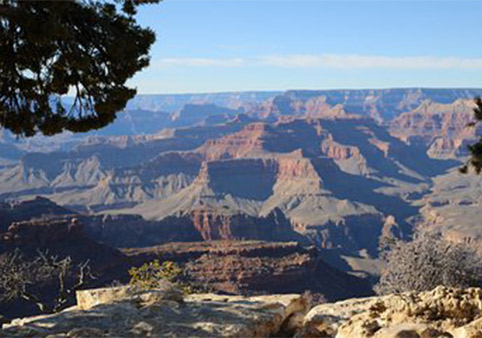
The Grand Canyon forms the southern anchor of many Grand Circle journeys. The Colorado River has cut through uplifted rock, revealing an immense sequence of cliffs, slopes, side canyons, plateaus, and ancient basement rocks.
The South Rim and North Rim provide very different approaches to the canyon. They face one another across the landscape but are separated by distance, elevation, seasonal access, and a lengthy drive around the canyon.
Related guides: South Rim » | North Rim » | Colorado River »
Zion National Park
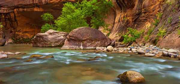
Zion National Park protects high plateaus, narrow canyons, sandstone cliffs, rock towers, hanging gardens, desert environments, and wooded elevations in southwestern Utah.
Zion Canyon is the park's best-known landscape, but Zion also includes the high country of Kolob Terrace and the separate Kolob Canyons area. Water has played a central role in cutting passages through the park's massive sandstone formations.
Bryce Canyon National Park
Bryce Canyon is not a single river-carved canyon. It is a series of amphitheaters eroded into the eastern edge of the Paunsaugunt Plateau.
Frost, precipitation, erosion, and the varying resistance of rock layers have helped form the park's hoodoos, fins, windows, and colorful slopes. Its high elevation also creates forests, temperatures, and seasonal conditions that differ sharply from lower desert destinations.
Grand Staircase-Escalante
Grand Staircase-Escalante National Monument protects an expansive landscape of plateaus, cliffs, slot canyons, badlands, river corridors, fossil resources, and remote backcountry.
The Grand Staircase refers to a broad sequence of rising cliffs and plateaus extending northward from the Grand Canyon region. The Escalante landscape contains a complex network of canyons draining toward the Colorado River.
Capitol Reef National Park
Capitol Reef National Park follows the Waterpocket Fold, a long wrinkle in the Earth's crust that has exposed tilted rock layers, cliffs, domes, narrow canyons, natural bridges, and desert landscapes.
The Fremont River creates a greener corridor through part of the park. The Fruita district also preserves evidence of Indigenous history, later settlement, orchards, and changing relationships between people and an arid environment.
Arches National Park
Arches National Park contains a remarkable concentration of natural stone arches along with fins, pinnacles, balanced rocks, cliffs, and broad views across eastern Utah.
The arches formed through a combination of deeply buried salt, fracturing, uplift, erosion, freezing and thawing, gravity, and the gradual removal of weaker rock. They are temporary features within a landscape that continues to change.
Canyonlands National Park
Canyonlands is a vast landscape carved by the Colorado and Green rivers. Canyons, mesas, buttes, fins, spires, arches, and remote river corridors divide the park into distinct districts.
Island in the Sky, The Needles, The Maze, and the river corridors are not connected by a simple internal road. Each provides a different perspective on the forces that shaped the central Colorado Plateau.
Glen Canyon and Lake Powell
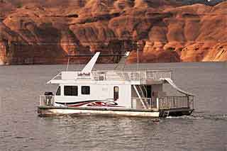
Glen Canyon National Recreation Area surrounds a long section of the Colorado River and Lake Powell. Its landscape includes flooded canyon corridors, exposed sandstone, side canyons, mesas, archaeological places, river access points, and desert ecosystems.
Lake Powell was created after Glen Canyon Dam blocked the Colorado River. Changing reservoir levels continue to alter shorelines, access, ecosystems, and the visibility of features that were submerged after the dam's construction.
Related guides: Glen Canyon » | Lees Ferry » | Glen Canyon Dam »
Horseshoe Bend
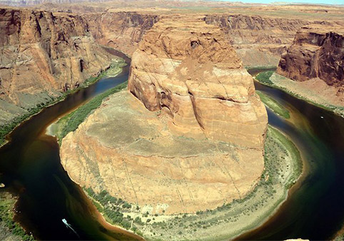
Horseshoe Bend is a deeply entrenched meander of the Colorado River near Page, Arizona. From the rim, the river can be seen curving around a massive sandstone formation far below.
The bend is part of the Glen Canyon landscape rather than Grand Canyon National Park. Its shape helps illustrate how a river can preserve a winding course while cutting downward into an uplifting plateau.
Antelope Canyon
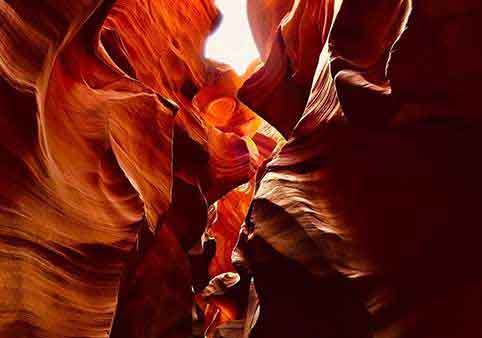
Antelope Canyon is a system of narrow sandstone slot canyons on Navajo Nation land near Page, Arizona. Flash flooding, sediment, flowing water, and abrasive particles have helped sculpt its curving walls and confined passages.
Access is controlled by the Navajo Nation and authorized Navajo tour operators. Antelope Canyon should be understood as part of a living cultural landscape, not simply as a photographic formation detached from its people and setting.
Monument Valley
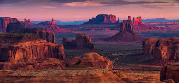
Monument Valley lies within the Navajo Nation along the Arizona-Utah border. Its immense sandstone buttes, mesas, towers, and open desert have become internationally recognized symbols of the American Southwest.
Monument Valley is not a national park. It is a Navajo Tribal Park and part of Diné homeland. Its cultural meaning cannot be reduced to scenery or its long history as a setting for movies and advertising.
Mesa Verde National Park
Mesa Verde preserves ancestral Pueblo communities and cultural landscapes in southwestern Colorado. Its archaeological places include cliff dwellings, mesa-top villages, ceremonial structures, agricultural features, roads, and other evidence of generations of community life.
The people who lived at Mesa Verde did not vanish. Their descendants are members of present-day Pueblo nations whose histories, traditions, and cultural connections continue.
Traveling Through the Grand Circle
Grand Circle destinations may appear close together on a regional map, but road travel can involve long distances, mountain passes, desert highways, seasonal closures, construction, limited services, and changes in elevation.
Conditions also vary greatly from place to place. Snow may affect a high plateau while lower desert areas remain dry and warm. Thunderstorms can create flash-flood hazards far from where rain is visible. Remote roads may have limited fuel, water, cellular service, or emergency assistance.
Entrance systems, permits, operating hours, road access, and reservation requirements are managed separately by each park, agency, or Tribal government. Current information should always be checked with the authority responsible for the place being visited.
Respect Different Lands and Authorities
The Grand Circle crosses national parks, monuments, recreation areas, national forests, state lands, private property, and the sovereign lands of multiple Tribal nations.
A location appearing on a map does not automatically mean it is open to public access. Follow the rules of the appropriate land-management authority, obtain required permits, remain on authorized routes, and respect closures and culturally sensitive places.
Continue Exploring GrandCanyon.net
Return to the Grand Canyon, discover activities within the landscape, or learn about the natural and human stories connecting the Colorado Plateau.