Lees Ferry is one of the few places in the Grand Canyon region where visitors can drive directly to the Colorado River. Located near the mouth of the Paria River in northern Arizona, it marks the transition between Glen Canyon National Recreation Area and Grand Canyon National Park and serves as the traditional starting point for river trips through the Grand Canyon.
The landscape is important for more than rafting. Lees Ferry was once a vital river crossing between settlements north and south of the Colorado River. Historic buildings, the remains of the ferry settlement, and nearby Lonely Dell Ranch preserve the story of the families who lived and worked in this isolated canyon corridor.
Visitors today can walk beside the river, explore the historic ranch and orchard, watch rafting crews prepare for long journeys downstream, fish the cold-water reach below Glen Canyon Dam, or simply experience the Colorado River at ground level rather than viewing it from a distant rim.
Check Current Conditions Before Visiting
Campground availability, river access, fishing regulations, launch requirements, road conditions, closures, and seasonal services can change. Review current National Park Service information for Glen Canyon National Recreation Area before traveling.
Why Is Lees Ferry Important to the Grand Canyon?
Lees Ferry occupies a rare break in hundreds of miles of steep canyon country. Near the mouth of the Paria River, the surrounding terrain made it possible for people, livestock, wagons, and later vehicles to approach the Colorado River from both sides.
That accessibility gave the location several different roles over time. Indigenous peoples had traveled through and lived within the wider region for generations before Euro-American settlement. During the late nineteenth and early twentieth centuries, the ferry became an important transportation link between Utah and northern Arizona. Today, it is a historic site, fishing destination, recreation area, and major launch point for Colorado River trips.
Where the Grand Canyon River Journey Begins
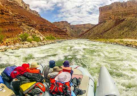
For river runners, Lees Ferry is River Mile 0. Commercial and permitted noncommercial expeditions prepare their boats here before traveling downstream through Marble Canyon and into the deeper Grand Canyon.
At the launch area, the river may appear comparatively calm and contained between low canyon walls. That setting changes dramatically downstream as the cliffs rise, tributaries enter the river, rapids become more frequent, and increasingly ancient rocks appear near river level.
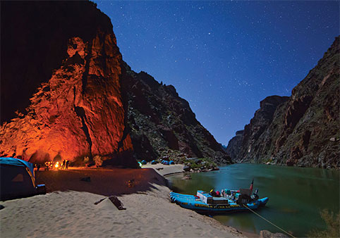
Watching crews rig boats provides a glimpse of the preparation required for a journey that may last days or weeks. Food, drinking water, camping equipment, safety gear, waste systems, and personal supplies must be organized before the boats leave the launch.
While You’re Here, Notice...
The river at Lees Ferry does not yet look like the Colorado River seen from the South Rim. The surrounding cliffs are lower, the water is accessible, and the Inner Gorge has not yet enclosed the river. Lees Ferry is the beginning of the geological transition into the Grand Canyon.
The Boundary Between Glen Canyon and Grand Canyon
Lees Ferry sits at an important administrative and geographical transition. The area around the launch is managed as part of Glen Canyon National Recreation Area, while the river corridor immediately downstream enters Grand Canyon National Park.
The distinction matters because boating permits, camping regulations, fishing rules, and other visitor requirements can change across the boundary. River travel downstream beyond the permitted launch area requires authorization from Grand Canyon National Park.
Lees Ferry is also used as an important reference point in management of the Colorado River Basin. The division between the Upper and Lower Colorado River basins is measured at Lees Ferry, connecting this seemingly quiet location with water management across seven states and Mexico.
Why Was a Ferry Established Here?
Deep canyons made crossing the Colorado River extremely difficult across much of northern Arizona. The area near the mouth of the Paria River was one of the few places where wagons could approach the river from both sides.
A ferry operation was established during the 1870s and became associated with John D. Lee, for whom the site was later named. The first substantial ferryboat began operating in 1873, carrying settlers, travelers, livestock, freight, and eventually automobiles across the river.
The crossing was never entirely predictable. River levels, currents, weather, equipment failures, and floods could interrupt service or make the journey dangerous. Nevertheless, Lees Ferry remained a critical link between communities in Utah and Arizona until a permanent bridge provided a safer route.
How Navajo Bridge Ended the Ferry Era
Construction of a steel bridge began downstream at Marble Canyon in 1927. The ferry sank in a fatal accident in 1928 and was not replaced because the bridge was already nearing completion.
The bridge opened to traffic in January 1929, ending the need for vehicles and travelers to cross the Colorado River by ferry. It was later renamed Navajo Bridge.
The change transformed regional travel. A crossing once controlled by river conditions became a dependable highway route, while Lees Ferry gradually shifted from transportation corridor to historic and recreational destination.
What Can You See and Do at Lees Ferry?
Lees Ferry rewards visitors who spend time exploring beyond the boat ramp. The historic district, Lonely Dell Ranch, riverbank, desert trails, campground, and nearby canyon scenery reveal several layers of the area’s story.
Explore the Historic Ferry District
A self-guided route near the river passes remnants and surviving structures associated with the ferry settlement. Stone buildings, foundations, machinery, and other features recall the period when this isolated location served travelers moving through the region.
The landscape itself helps explain the difficulty of life here. Summer heat can be intense, shade is limited, and the surrounding cliffs create a sense of isolation even though a paved road now reaches the river.
Visitors should leave historic structures and artifacts undisturbed. These remains are protected cultural resources rather than abandoned objects available for collection.
Walk Through Lonely Dell Ranch
Lonely Dell Ranch stands near the Paria River a short distance from the main ferry area. Families who operated the crossing needed to be largely self-sufficient because supplies and services were difficult to obtain.
Residents used irrigation to create fields, gardens, and an orchard within the arid landscape. Surviving ranch buildings, farm features, a cemetery, and the maintained orchard preserve the story of the people who lived at the crossing.
The approximately one-mile self-guided walk is relatively easy, but the route may be hot and exposed. Interpretive signs explain how the ranch supported the ferry community and how different families modified the property over time.
While You’re at the Ranch, Notice...
The green orchard is not a natural desert oasis. It reflects years of irrigation, maintenance, and physical labor by families trying to grow food in an isolated canyon environment.
Walk Along the Colorado River
The River Trail follows portions of the historic waterfront near the boat launch. The route allows visitors to see the Colorado River, historic structures, and the canyon walls from close range.
Unlike overlooks where the river appears as a thin ribbon far below, Lees Ferry places visitors directly beside the water. Its speed, temperature, color, and scale become much easier to appreciate from the shoreline.
Trail surfaces vary from gravel to rock and sand, and shade is limited. Hot-weather hiking should be kept conservative, with water carried from the start.
Hike the Spencer Trail
The Spencer Trail climbs steeply above Lees Ferry through a series of switchbacks. The approximately 4.4-mile round trip gains about 1,700 feet and provides elevated views of the Colorado River, Paria River corridor, and surrounding cliffs.
This is a strenuous desert hike rather than a casual overlook walk. Exposure, heat, steep terrain, loose rock, and limited shade make cool-weather starts especially important.
Visitors seeking an easier experience should explore Lonely Dell Ranch or portions of the River Trail rather than attempting Spencer Trail during unsuitable conditions.
Watch Grand Canyon River Trips Launch
Lees Ferry is one of the most interesting places to observe how Grand Canyon rafting expeditions begin. Commercial and private groups may spend hours organizing equipment, checking boat loads, and preparing for the controlled uncertainty of a long river journey.
Remain outside working areas and do not interfere with launch operations. The ramp is an active transportation and safety zone, not simply a scenic beach.
Fishing at Lees Ferry
The cold, clear reach of the Colorado River between Glen Canyon Dam and Lees Ferry supports a well-known rainbow trout fishery. The fishery exists largely because water released from deep within Lake Powell remains colder than the river’s historic seasonal temperatures.
Fishing regulations differ by river section and may specify allowable tackle, hooks, possession limits, or protected areas. Anglers need an appropriate Arizona fishing license and should check current regulations before entering the water.
The trout fishery also exists within a larger and complicated river ecosystem. Managers monitor nonnative trout and predatory fish because populations upstream can affect native fish living farther downstream in the Grand Canyon.
Camping at Lees Ferry
A National Park Service campground overlooks the river corridor. Sites are exposed, with limited natural shade, but the setting provides convenient access to Lees Ferry, Lonely Dell Ranch, the river, and nearby Marble Canyon.
Campground loops or individual sites may close for construction or maintenance. Visitors should verify current availability, fees, water status, and facility conditions before depending on the campground.
How Should You Plan a Visit to Lees Ferry?
Lees Ferry is located near Marble Canyon in northern Arizona. The turnoff is west of Navajo Bridge along U.S. Highway 89A, and a paved access road continues approximately five miles to the historic district, campground, and Colorado River.
The site is approximately 42 miles by road from Page and about 85 miles from the developed North Rim area, although seasonal road closures can affect North Rim travel. It is not a convenient side trip from Grand Canyon Village on the South Rim.
How Much Time Should You Allow?
| Available Time | Suggested Experience |
|---|---|
| 30 to 45 minutes | Visit the boat ramp, walk beside the river, and view the historic ferry area. |
| 1 to 2 hours | Add Lonely Dell Ranch and the orchard. |
| Half day | Explore the historic district, ranch, river trail, and nearby Navajo Bridge area. |
| Full day | Include fishing, a longer hike, or a guided smooth-water river experience. |
When Is the Best Time to Visit?
Spring and fall generally provide the most comfortable conditions for walking and exploring. Summer temperatures can become extreme, particularly along exposed trails and historic areas with little shade.
Winter days may be pleasant, but freezing temperatures, wind, and occasional winter weather remain possible. River water is cold throughout the year, and air temperature should never be used to judge whether swimming conditions are safe.
What Should You Bring?
- Drinking water, including extra water during warm weather.
- Sun protection, including a hat, sunscreen, and protective clothing.
- Supportive footwear for gravel, rock, and sand.
- Downloaded maps or directions because mobile coverage may be unreliable.
- Seasonal layers for wind and rapid temperature changes.
- Fishing license and current regulations when angling.
- Life jackets and required safety equipment for authorized boating.
Is Lees Ferry Part of Grand Canyon National Park?
The developed Lees Ferry area is within Glen Canyon National Recreation Area. The Grand Canyon National Park river corridor begins immediately downstream from the launch area.
This makes Lees Ferry a gateway rather than a conventional Grand Canyon National Park entrance. Visitors can experience the Colorado River and the beginning of the Grand Canyon river journey, but they are not entering the South Rim or North Rim developed areas.
Frequently Asked Questions
Why is Lees Ferry famous?
Lees Ferry is known as a historic Colorado River crossing and as the primary launch point for river trips through Grand Canyon National Park.
Can you drive to the Colorado River at Lees Ferry?
Yes. A paved road reaches the developed Lees Ferry area, making it one of the few places in the region where visitors can drive directly to the Colorado River.
Is there still a ferry at Lees Ferry?
No. Ferry service ended after a fatal sinking in 1928 and the opening of the nearby bridge in 1929.
Is Lees Ferry inside Grand Canyon National Park?
The developed area and launch are within Glen Canyon National Recreation Area. Grand Canyon National Park begins immediately downstream along the river corridor.
Do Grand Canyon rafting trips begin at Lees Ferry?
Most commercial and permitted noncommercial river trips through the main Grand Canyon corridor launch at Lees Ferry.
Can visitors walk around Lees Ferry without a river permit?
Yes. A Grand Canyon river permit is not required simply to visit the historic district, walk along the shoreline, or explore Lonely Dell Ranch. Boating and backcountry activities may have separate requirements.
Can you fish at Lees Ferry?
Yes. The river reach below Glen Canyon Dam is a well-known trout fishery. An Arizona fishing license and compliance with current regulations are required.
Is Lees Ferry worth visiting without taking a raft trip?
Yes. Visitors can explore the historic ferry district, Lonely Dell Ranch, the orchard, the Colorado River shoreline, desert trails, and the landscape where Glen Canyon transitions into the Grand Canyon.
How far is Lees Ferry from Page?
Lees Ferry is approximately 42 miles by road from Page via U.S. Highway 89 and U.S. Highway 89A.
Can you swim in the Colorado River at Lees Ferry?
The river is cold, swift, and potentially dangerous even during hot weather. Visitors should not enter casually and should follow all posted safety guidance.
Continue Exploring the Grand Canyon Region
Lees Ferry connects the human history of the Colorado River with the beginning of the Grand Canyon river corridor. Continue exploring how the river, geology, public lands, and canyon destinations fit together.