Yavapai Geology Museum is the best place on the South Rim to connect the Grand Canyon’s immense scenery with a clear explanation of how the landscape formed. Perched directly on the rim at Yavapai Point, the museum uses panoramic windows, rock-column models, photographs, diagrams, and interpretive exhibits to help visitors identify the layers and landforms visible outside.
The museum is especially useful early in a Grand Canyon visit. A short stop inside can make every later viewpoint more meaningful because visitors begin recognizing the difference between the pale sedimentary cliffs near the rim, the darker rocks of the Inner Gorge, and the complex network of side canyons shaped by erosion.
Yavapai Geology Museum is not a large natural-history museum designed to cover every scientific topic. Its strength is focus: the building, exhibits, and view work together to explain the geological story unfolding directly beyond the windows.
Check Current Hours and Programs
Museum hours, ranger talks, shuttle schedules, and visitor services may change seasonally or because of park operations. Confirm current National Park Service information before relying on a specific schedule.
What Can You Learn at Yavapai Geology Museum?
The museum explains three connected parts of the Grand Canyon story: how the visible rock layers formed, how the Colorado Plateau rose, and how erosion helped carve the modern canyon. Rather than presenting those ideas as isolated facts, the exhibits connect them to formations visitors can see through the windows.
Annotated displays beneath the panoramic windows show where to look for major groups of rocks. This makes the museum especially effective for visitors who find geological diagrams difficult to translate into a real landscape. You can study an exhibit, look up, and immediately compare the explanation with the canyon itself.
Panoramic Windows and Labeled Views
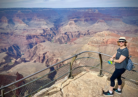
The museum’s broad windows are central to the experience. The building was placed where visitors could look across the central Grand Canyon and compare the upper cliffs, broad terraces, isolated formations, and darker Inner Gorge from one location.
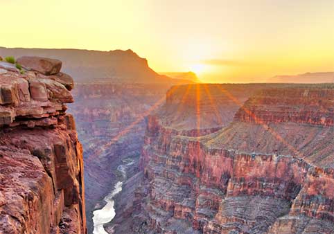
Labels and interpretive displays help visitors identify major features without turning the view into a dense field lesson. The goal is not to memorize every formation name, but to understand the larger pattern: younger sedimentary rocks generally appear near the rim, while much older rocks are exposed deeper in the canyon.
While You’re Here, Notice...
Follow one visible rock layer horizontally across the canyon. Even when ridges and side canyons interrupt the view, the same band often reappears on distant formations, revealing that these rocks once extended across a much broader landscape.
Rock-Column Models of the Rims
Visitors can walk between models representing the rock sequences of the North Rim and South Rim. These columns make it easier to compare the canyon’s vertical layers and understand why the higher North Rim contains rocks and environments that differ from those found along the South Rim.
The models also help explain why the Grand Canyon should not be understood as a simple hole cut through identical stone. Each layer formed under different environmental conditions, and each responds differently to erosion. Resistant rocks create cliffs, while softer formations often produce slopes and terraces.
How the Canyon Was Carved
The exhibits explain that no single process created the Grand Canyon by itself. Deposition built the rock layers, tectonic forces raised the Colorado Plateau, and the Colorado River and its tributaries carried away enormous quantities of rock and sediment over time.
Rain, snowmelt, freezing and thawing, rockfalls, landslides, and side-stream erosion continue changing the canyon today. The museum helps visitors see the Grand Canyon not as a finished monument, but as an active landscape that is still being shaped.
Fossils and Ancient Environments
Geology exhibits also help visitors understand that many of the canyon’s rocks preserve evidence of environments very different from northern Arizona today. Ancient seas, coastal plains, rivers, mudflats, and windblown dunes all contributed to the layers visible from the rim.
Fossils and sedimentary structures provide clues to those past environments. They do not represent dinosaurs wandering through the open canyon, but much older forms of life and landscapes preserved within rocks that existed long before the modern canyon formed.
Grand Canyon Rock Layers
The museum is an ideal introduction to the major rock formations, but visitors who want a more complete explanation can continue through the site’s comprehensive rock-layer guide.
Why Was the Museum Built at Yavapai Point?
The original structure was dedicated in 1928 as the Yavapai Point Trailside Museum, later known as Yavapai Observation Station. Architect Herbert C. Maier designed the building after a team of geologists selected the site specifically for observing and interpreting Grand Canyon geology.
That decision explains why the museum feels inseparable from the overlook. It was not built first and filled with exhibits later. The location, windows, architecture, and interpretive purpose were conceived together so visitors could study the canyon while looking directly into it.
Architecture Designed Around the View
Maier used local Kaibab limestone and ponderosa pine so the structure would blend into the South Rim landscape. The building remains low and visually restrained, allowing the canyon to dominate the experience.
Its architecture represents an early National Park Service approach to trailside museums: small interpretive buildings placed directly within the landscapes they were designed to explain. Yavapai Observation Station became one of the early examples of this museum concept in the national park system.
Look at the Building Before Entering
Notice how the stone walls, low roofline, and natural materials visually anchor the museum to the rim. The building directs attention outward rather than competing with the landscape it was designed to interpret.
From Observation Station to Geology Museum
The building has served visitors under several names, including Yavapai Observation Station, Yavapai Museum of Geology, and Yavapai Geology Museum. Its core purpose has remained remarkably consistent: helping people understand the canyon through direct observation.
Modern exhibits explain the deposition of rock layers, uplift of the Colorado Plateau, and carving of the Grand Canyon using models, artwork, photographs, specimens, and interpretive panels. The exhibits have evolved, but the panoramic relationship between science and scenery remains the museum’s defining feature.
A Museum That Supports the Viewpoint
The museum and Yavapai Point serve different but complementary roles. The viewpoint page explains why the overlook is worth visiting, what can be seen from it, and how to reach it. The museum provides the indoor tools needed to understand that view.
Visitors gain the most from the area by treating the overlook and museum as one connected experience: look into the canyon, examine the displays, and then return outside to identify what you have learned.
How Should You Visit Yavapai Geology Museum?
Most visitors should allow approximately 30 to 45 minutes inside the museum, with additional time for Yavapai Point and the nearby Rim Trail. Visitors who read the exhibits carefully, attend a ranger program, or walk part of the Trail of Time may spend considerably longer.
Parking is available beside the museum but is limited. The Kaibab Rim Orange Route shuttle stops at Yavapai Geology Museum, and visitors can also walk approximately 0.7 mile from the Grand Canyon Visitor Center and Mather Point area along the paved Rim Trail.
Best Order for a First Visit
Begin at Yavapai Point
Spend a few minutes looking across the central canyon before reading the exhibits. Notice the horizontal rock layers, broad terraces, and darker Inner Gorge.
Explore the Museum
Use the panoramic displays and rock-column models to identify what you saw outside.
Return to the Overlook
Look again after visiting the exhibits. The same view often becomes easier to read once you understand the basic geological structure.
Continue Along the Trail of Time
Walk west from the museum to experience geologic time through distance, markers, rock samples, and changing canyon views.
The Trail of Time Connection
The Trail of Time begins a short distance west of the museum along the Rim Trail. It expands the museum’s lessons into an outdoor timeline where distance represents the immense age of Earth and the rocks exposed in the Grand Canyon.
The museum explains geological ideas through exhibits and a carefully framed view. The Trail of Time turns those ideas into a walk. Visitors can experience both without unnecessary duplication because each uses a different form of interpretation.
Ranger Programs
The National Park Service periodically offers geology talks at or near Yavapai Geology Museum. These programs can help visitors ask questions, identify visible formations, and understand geological processes in more conversational language.
Program times and seasonal availability change, so check the current ranger-program schedule rather than relying on a permanently listed time.
Accessibility
The museum, principal overlook, parking area, shuttle stop, and major connecting paths are paved and accessible to many visitors using wheelchairs, scooters, walkers, or strollers.
Crowding, grades, weather, snow, and individual mobility needs can affect the experience. Visitors planning a longer walk toward Mather Point or Historic Grand Canyon Village should review current accessibility information for the specific section.
Park Store
A Grand Canyon Conservancy park store operates inside the museum. It offers books, maps, educational materials, and other canyon-related items. Purchases help support Grand Canyon National Park through its official nonprofit partner.
Frequently Asked Questions
Is Yavapai Geology Museum worth visiting?
Yes. It is the best indoor location on the South Rim for connecting the canyon view with explanations of rock layers, geologic time, uplift, erosion, and the Colorado River.
How much time should I spend in the museum?
Allow approximately 30 to 45 minutes for the exhibits. Add more time for Yavapai Point, a ranger program, or a walk along the Trail of Time.
Does the museum charge admission?
There is no separate museum admission charge. Access is included with entry to Grand Canyon National Park.
Who designed Yavapai Geology Museum?
Architect Herbert C. Maier designed the original Yavapai Point Trailside Museum, which was dedicated in 1928.
Why was the museum built at Yavapai Point?
A team of geologists selected the location specifically because its panoramic view provides an excellent place to observe and interpret Grand Canyon geology.
Is the museum wheelchair accessible?
The museum, main overlook, nearby parking, shuttle stop, and principal paths are paved and accessible to many visitors using mobility devices.
Can you walk to the museum from Mather Point?
Yes. The paved Rim Trail connects Mather Point and the Visitor Center area with Yavapai Geology Museum over approximately 0.7 mile.
Is the Trail of Time inside the museum?
No. The Trail of Time is an outdoor interpretive walk that begins a short distance west of the museum along the Rim Trail.
Are there geology ranger talks?
The National Park Service offers geology programs seasonally and according to current staffing. Check the park’s daily program schedule for current times.
Continue Exploring Grand Canyon Geology
Yavapai Geology Museum provides the interpretive tools needed to understand the canyon visible through its windows. Continue exploring the overlook, outdoor timeline, rock layers, and geological processes that bring that story into focus.