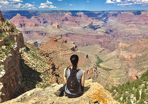
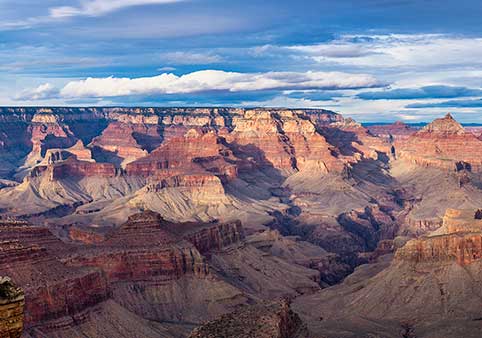
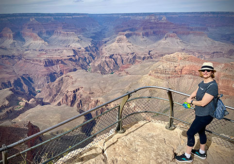
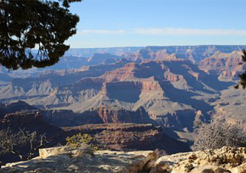
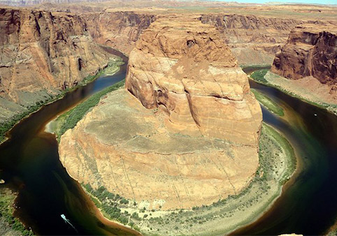
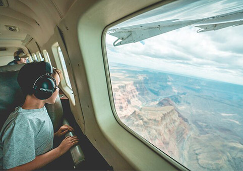
The Grand Canyon is far more than a deep canyon carved by the Colorado River. Look across the landscape from almost any overlook and you'll see towering cliffs, broad mesas, isolated buttes, winding side canyons, steep talus slopes, and massive rock formations with names like Isis Temple, Cheops Pyramid, and Wotan's Throne. Each feature tells part of the canyon's geological story.
These landforms were not created all at once. They developed over millions of years as rivers, weather, gravity, and changing climates slowly sculpted the uplifted Colorado Plateau. Different rock layers erode at different rates, producing the dramatic stair-step appearance that makes the Grand Canyon one of the world's most recognizable landscapes.
Learning to recognize these landforms transforms a visit to the Grand Canyon. Instead of seeing a collection of colorful rocks, visitors begin to understand how geology, erosion, and time work together to shape an ever-changing landscape.
The Grand Canyon's Landscape
Every overlook provides a cross-section through hundreds of millions of years of geological history. The shapes visible today are controlled by three primary factors: the types of rock present, the forces of erosion, and the immense amount of time available for those processes to work.
Reading the Canyon
At first glance, the Grand Canyon may appear chaotic, but its landscape follows recognizable geological patterns. Resistant rock layers form towering cliffs, while softer rocks weather into broad slopes. Rivers carve valleys, gravity pulls rocks downhill, and smaller streams create branching side canyons.
Once you understand these patterns, the canyon becomes much easier to interpret. Features that once appeared random begin to reveal the geological processes that created them.
Why the Landscape Looks Layered
The Grand Canyon's distinctive appearance comes from its stacked sedimentary rock layers. Because these formations were deposited one atop another over hundreds of millions of years, erosion cuts through them like slices in a layer cake.
Harder rocks such as limestone and sandstone resist erosion and remain as steep cliffs. Softer rocks like shale weather more quickly, producing gentler slopes between the cliffs. This repeating pattern creates the canyon's characteristic stair-step profile.
The Role of Erosion
Although the Colorado River is responsible for carving the canyon's deepest channel, it is only one of several forces shaping the landscape. Rain, snow, flash floods, freezing temperatures, plant roots, wind, and gravity all contribute to breaking apart the rock.
Over time, these processes widen the canyon, create side valleys, trigger rockfalls, and expose new sections of Earth's geological history. The Grand Canyon is not a finished landscape but one that continues evolving today.
Major Grand Canyon Landforms
The canyon contains a wide variety of geological features, each formed by a combination of rock type, erosion, and time. Learning to identify these landforms helps visitors better appreciate the complexity of the landscape.
Cliffs
Many of the Grand Canyon's most dramatic walls are cliffs formed by resistant rock layers. Formations such as the Redwall Limestone, Coconino Sandstone, and Kaibab Formation withstand erosion better than surrounding rocks, allowing them to remain steep while softer layers gradually wear away.
These resistant formations create the towering walls that dominate many canyon views. As erosion undercuts the cliffs, large blocks occasionally break free, contributing to the canyon's ongoing evolution.
Slopes
Between the cliffs are broad, gently inclined slopes created by softer rock layers such as the Bright Angel Shale and Hermit Formation. These rocks break apart more easily when exposed to water, frost, and gravity, producing wide benches covered with loose sediment.
The alternating pattern of cliffs and slopes is one of the defining characteristics of the Grand Canyon and reflects differences in the durability of its rock layers.
The Tonto Platform
One of the canyon's most recognizable landforms is the Tonto Platform, a broad bench that stretches for many miles through the inner canyon. It formed where softer Bright Angel Shale eroded more rapidly than the resistant cliffs above and below it.
Because of its relatively gentle terrain, the Tonto Platform became an important travel route for both wildlife and people. Today, portions of the Tonto Trail follow this natural bench through the canyon.
The Inner Gorge
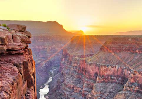
The deepest and oldest part of the Grand Canyon is known as the Inner Gorge. Here, the Colorado River flows through dark metamorphic and igneous rocks that formed nearly 1.8 billion years ago. These Vishnu Basement Rocks are among the oldest exposed rocks in North America and represent the geological foundation of the canyon.
Unlike the broad upper canyon, the Inner Gorge is steep, narrow, and rugged. Resistant basement rocks weather much more slowly than the sedimentary layers above them, allowing the river to carve a deep, confined channel through the heart of the canyon.
Many overlooks along the South Rim provide excellent views of the Inner Gorge, where visitors can clearly see the dramatic transition from colorful sedimentary cliffs to the dark rocks surrounding the Colorado River.
Mesas
A mesa is a broad, flat-topped landform with steep sides. Mesas form when resistant rock protects the softer layers beneath from erosion. Over millions of years, streams and weathering remove the surrounding landscape, leaving isolated highlands behind.
The word "mesa" comes from the Spanish word for "table," an appropriate description for these expansive, flat summits. Large mesas often represent remnants of landscapes that once stretched continuously across the Colorado Plateau.
Buttes
As erosion continues, mesas gradually become smaller. Once a mesa loses much of its flat top and becomes more isolated, it is generally classified as a butte. Buttes are narrower than mesas but form through the same geological processes.
Many of the canyon's iconic landmarks, including several visible from Desert View and Hopi Point, are buttes that stand hundreds or even thousands of feet above the surrounding terrain. They are temporary features on a geological timescale and will continue shrinking as erosion slowly wears them away.
Temples
Some of the Grand Canyon's largest isolated rock formations are known as temples. Early explorers, including geologist Clarence Dutton in the late 1800s, named many of these massive formations after deities and sacred places from cultures around the world. Names such as Isis Temple, Shiva Temple, Brahma Temple, and Wotan's Throne remain in use today.
Despite their distinctive names, temples are not a separate type of landform. Most are exceptionally large buttes or mesas whose immense size and isolation inspired Dutton's naming convention. Their towering appearance results from resistant rock layers protecting the softer formations beneath.
Side Canyons
The Grand Canyon is far more than a single canyon. Hundreds of side canyons branch away from the main Colorado River, creating the intricate network of valleys that gives the landscape its remarkable complexity.
Most side canyons were carved by smaller streams and washes flowing toward the Colorado River. During seasonal storms, flash floods carry tremendous amounts of water and sediment through these narrow channels, deepening them over thousands and millions of years.
Many of today's popular hiking routes, including Bright Angel Canyon and Havasu Canyon, follow these tributary valleys that continue to evolve with every major storm.
Talus Slopes
Look beneath nearly every major cliff and you'll notice piles of broken rock accumulating at its base. These are known as talus slopes, and they form as gravity pulls loose rocks downward after they are weakened by weathering.
Freeze-thaw cycles are especially important in the Grand Canyon. Water seeps into cracks, freezes during cold weather, expands, and gradually forces the rock apart. Eventually, pieces break loose and tumble down the cliffs, collecting as talus below.
Although talus slopes may appear stable, they are active geological features. New rockfalls continue to add material, while floods and gravity slowly redistribute the debris over time.
Geological Forces Still at Work
Although the Grand Canyon appears timeless, it is constantly changing. The same geological processes that shaped the landscape over millions of years continue to operate today, gradually altering cliffs, slopes, river channels, and side canyons.
Weathering Never Stops
Weathering is the process of breaking rock into smaller pieces without transporting it away. In the Grand Canyon, temperature changes, ice, rain, plant roots, and chemical reactions all weaken exposed rock. Over time, these processes prepare material for erosion and help shape the canyon's cliffs and slopes.
Rockfalls Shape the Canyon
Large rockfalls occur throughout the Grand Canyon every year. Some involve only a few loose stones, while others send thousands of tons of rock crashing into the canyon below. Most occur naturally after heavy rainfall, freeze-thaw cycles, or long periods of gradual weathering.
Although dramatic, rockfalls are a normal part of the canyon's evolution. They widen the canyon, expose fresh rock surfaces, and contribute to the formation of talus slopes at the base of cliffs.
Flash Floods Continue the Work
While the Colorado River carries water year-round, many of the Grand Canyon's side canyons remain dry for much of the year. During summer monsoon storms or periods of heavy rainfall, these normally quiet washes can become powerful flash floods capable of moving boulders, uprooting trees, and rapidly reshaping stream channels.
Although these floods are brief, they are among the most effective erosional forces within the canyon. Over thousands of years, repeated floods deepen tributary valleys, transport sediment into the Colorado River, and gradually widen side canyons.
Faults Help Shape the Landscape
Faults are fractures in Earth's crust where rocks have moved relative to one another. The Grand Canyon contains numerous faults that formed long before the modern canyon developed. While these faults did not create the canyon itself, they influenced how erosion progressed across the landscape.
Fault zones often contain fractured rock that erodes more easily than surrounding formations. Rivers and streams frequently followed these zones of weakness, helping determine the location of certain tributary canyons and influencing the shape of nearby cliffs and mesas.
Several well-known faults, including the Bright Angel Fault, can be seen from overlooks or encountered on hiking trails. These structures provide important clues about the region's tectonic history and continue to be studied by geologists today.
A Landscape Still Changing
Although the Grand Canyon appears permanent, it remains an active landscape. Every year, weathering loosens additional rock, gravity produces new rockfalls, flash floods reshape side canyons, and the Colorado River continues carrying sediment downstream.
These changes are usually too slow to notice during a single visit, yet over thousands and millions of years they continually reshape the canyon. The Grand Canyon is best understood not as a finished monument, but as a landscape still being sculpted by natural processes.
Frequently Asked Questions
What is the difference between a mesa and a butte?
Both are isolated, flat-topped landforms formed by erosion. A mesa is generally much larger, while a butte is a smaller remnant left behind as erosion continues to wear away the surrounding rock.
What is the Inner Gorge?
The Inner Gorge is the deepest part of the Grand Canyon where the Colorado River flows through the ancient Vishnu Basement Rocks. These rocks formed approximately 1.7 to 1.8 billion years ago and represent the oldest exposed formations in the canyon.
Why are some canyon walls steep while others are gentle?
The difference is largely controlled by rock type. Resistant rocks such as limestone and sandstone form steep cliffs, while softer rocks like shale weather into broad slopes. This creates the canyon's distinctive stair-step appearance.
What are talus slopes?
Talus slopes are piles of broken rock that accumulate at the base of cliffs after rockfalls. They form as weathering weakens cliff faces and gravity pulls loose material downhill.
Why are the rock formations called temples?
Many of the canyon's largest buttes and mesas were named by geologist Clarence Dutton during the late 1800s. Inspired by their immense size, he chose names associated with mythological figures, deities, and sacred places from cultures around the world.
Did faults create the Grand Canyon?
No. The canyon was primarily carved by the Colorado River and its tributaries after the Colorado Plateau was uplifted. Existing faults influenced the path of erosion in some areas but were not responsible for creating the canyon itself.
Is the Grand Canyon still changing?
Yes. Rockfalls, weathering, flash floods, and the Colorado River continue reshaping the canyon. Although these changes occur slowly on a human timescale, the landscape remains geologically active.
Can visitors see these landforms from the rim?
Absolutely. Many overlooks, including Mather Point, Yavapai Point, Hopi Point, and Desert View, offer excellent views of mesas, buttes, temples, the Inner Gorge, side canyons, and the canyon's characteristic cliffs and slopes.
Continue Learning
The Grand Canyon's cliffs, mesas, buttes, and side canyons are the visible result of millions of years of geological processes. Continue exploring the rocks, history, and forces that shaped one of the world's most extraordinary landscapes.